Sunday, April 09, 2006
18. Colditz Castle: Chronology/History
BC: Prehistoric Times:
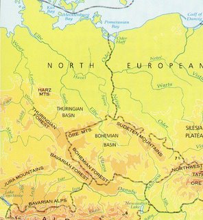
Hunters and gatherers were attracted to the mild and fertile Elbe river valley. Colditz will much later be founded roughly where the last "n" in Thuringian Basin is located. Image credit: Paul Robert Magocsi, Historical Atlas of East Central Europe, p. 3. ^
Prehistoric Saxony was the site of some of the largest of the ancient Central European monumental temples, dating from the 5th millennium BC. Text credit: wikipedia.
Notable archeological sites have been discovered in Dresden, and the village of Aythra near Leipzig. Text credit: wikipedia.
Before 100 BC - until 50 BC: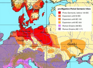
Areas inhabited by pre-migration period Germanic tribes from before between 100 BC and 50 BC (show in bright red and in bright orange) included the future site of Colditz.
BC: 49 - 1:
17 BC: Augustus understood that the Rhine frontier was still unstable and sent his adoptive sons Drusus and Tiberius to the north, where they had to pacify the tribes that were living between the Alps, Rhine and Elbe.
9 BC: This campaign was repeated in 9. One tribe, the Marcomanni, was so impressed, that its king Marbod decided to migrate with his people to Bohemia, far away from the Roman arms. In the summer, Drusus reached the river Elbe.
AD: 001 - 100 (The 1st century):
004: Although the Roman possessions on the east bank of the Rhine were not clearly defined, the region was tranquil, and remained so for the next decade and a half. At the beginning of our era, a general named Lucius Domitius Ahenobarbus even crossed the Elbe, and in 4 CE, Augustus decided that Germania had to become a normal province. Again, Tiberius was sent to the north. The army of Germania Inferior marched from the mouth of the Rhine through the inland to the sources of the Lippe, where a camp was built at Anreppen. Next year, the navy brought the legions to the mouth of the Elbe, and Tiberius marched along the river until he had reached the area of modern Dresden. (We have an eyewitness-account in the Roman History of Velleius Paterculus.)
005 - 006: The only part between the Elbe, Rhine and Danube that remained unconquered was the kingdom of Marbod, the leader of the Marcomanni. In the winter of 5/6, the army of Germania Superior marched to the east along the river Main and built a large base at Marktbreit. From here, two legions could attack Marbod; at the same time, Tiberius would march to the north from the Danube, where eight legions were gathered at Bratislava. It was to be the most grandiose operation that was ever conducted by a Roman army, but a rebellion in Pannonia obstructed its execution. Tiberius was occupied for three years until he had suppressed the insurrection.
009: Meanwhile, the army of Germania Inferior was commanded by Publius Quinctilius Varus, one of the most important senators of his age and a personal friend of Augustus. He had to make a normal province of the the country between the Lower Rhine and Lower Elbe, and had some success. However he was defeated by the Cheruscan leader Arminius in the battle in the Teutoburg Forest (September 9 CE). The Seventeenth, Eighteenth and Nineteenth legions were annihilated, and the Sixteenth Legion Gallica and I Germanica moved to the north to help V Alaudae secure the Rhine frontier.
The Elbe has long been an important delineator of European geography. The Romans knew the river as the Albis; however, they only attempted once to move the Eastern border of their empire forward from the Rhine to the Elbe, and this attempt failed in the Battle of the Teutoburg Forest in 9 AD, after which they never seriously tried again. Text credit: wikipedia.
009 -011: During the next three years, Tiberius was active on the east bank of the Rhine (he had only just suppressed the Pannonian revolt). Until then, about six legions had guarded the frontier; from now on, there were eight. The army of Germania Superior consisted of II Augusta, XIII Gemina, XIV Gemina, and XVI Gallica; I Germanica, V Alaudae, XX Valeria Victrix, and XXI Rapax were stationed in Germania Inferior. Diplomacy secured the alliance between the Romans and the Frisians and Chauci, but Arminius was able to create a federation of tribes. In 9, 10, and 11, Tiberius invaded Arminius' territory, but he did not want to reconquer the country between Rhine and Elbe: the Romans merely wanted to avenge themselves. It is likely that the construction of the Roman fort at Vechten is connected to this offensive.
012: In 12, Tiberius decided that it was enough, and accepted that the Rhine was the border of the Roman empire. He understood the Germans: left to their own, the federation of Arminius would soon disintegrate.
014 - 016: Two years later, Tiberius succeeded Augustus and became emperor. General Germanicus (a son of Drusus) now commanded the army of Germania Inferior. In 14, 15, and 16, he invaded the country between the Rhine and Elbe again, and was able to defeat Arminius in battle. The fort at Velsen was built as a naval base to support the attack. However, the renewed Roman attacks only served to strengthen Arminius' position, and Tiberius recalled his nephew. A few years later, the Germanic leader was assassinated.
028: From this moment on, Germania Inferior was only a small province: a small stretch of land to the southwest of the Lower Rhine, with the country of the Frisians and Chauci as an appendix. In 28, these tribes revolted, and although the Fifth legion Alaudae was able to overcome the rebels (tesxt), Tiberius gave up all territories on the other side of the Rhine. Germania Inferior was to remain an incomplete province.
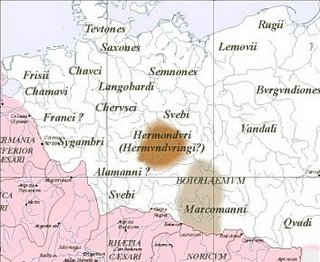
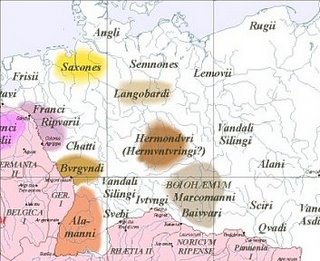
The Hermondvri [Hermunduri] people (show in brown)) occupied the region where Colditz would much later be founded. They were outside of the Roman Empire, shown in pink in this orientation map. Image credit: website. ^
"The Hermunduri (alternate spellings: Hermunduri, Hermunduli, Hermonduri, Hermonduli) were an ancient tribe of Germanic peoples who occupied the area around what is now Thuringia, Saxony, and Northern Bavaria, from roughly around 1 AD to 400 AD." Text Credit: wikipedia.
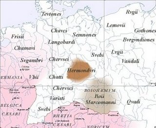
Just barely visible above the "o" in Hermondvri are the two hairlines that show the confluence of the Zwickauer Mulde and the Freiberger Mulda rivers. A few miles south of that confluence and on the left bank is where Colditz would much later be founded. Image credit: website. ^
The oldest seats of the Hermondvri people were located between the Thuringian Forest, the Ore Mountains, the Harz river, and the Black Elster river. Their area of settlement was north of a line from Eisenach west to Dresden. Text credit: website.
9: The Romans knew the river [Elbe] as the Albis; however, they only attempted once to move the Eastern border of their empire forward from the Rhine to the Elbe, and this attempt failed in the Battle of the Teutoburg Forest in 9 AD, after which they never seriously tried again. Text credit: wikpedia.
101 to 200 (The 2nd century):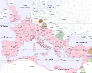 Another orientation map, since the Roman Empire had grown, but it still didn't and never would, include the Hermondvri lands. Image credit: website. ^
The Hermondvri were still in the same location for another century, but the Vandali to their east had moved closer to them. Image credit: website. ^
201 - 300 (The 3rd century): 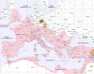
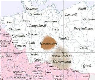
Orientation map showed Germanic frontier borders the same as they were in the previous century. Image credit: website. ^
This century saw the Hermondvri joined with the Hermvndvringi, but with a question mark, and the Vandali shifted back further east. Image credit: website. ^
301 - 400 (The 4th Century): 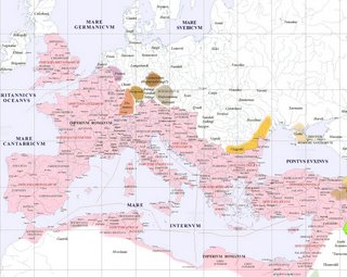
Orientation map showed Germanic incursions along the northern frontier, especially by the Alamanni. Image credit: website. ^
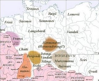
And through all these nearby changes and movements of Germanic tribes all around them, the Hermondvri/Hermvndvringi combination still sat right on top of Colditz's future location. Image credit:website. ^
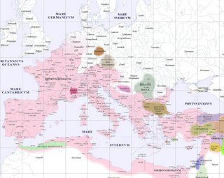
395: The Western Roman Empire in 395. ^
401 - 500 (The 5th Century):
Orientation map showed the major changes of the 5th century with Rome's "Fall". Image credit: website. ^
Still, through it all so far, the Hermondvri/Hermvndvringi held on in the Colditz area. Image credit: website. ^
450 - 452: Major invasion routes of the Huns (450-452) shown in green. Image credit: Paul Robert Magocsi, Historical Atlas of East Central Europe, p. 6. ^
450 - 453: Under Attila the Huns ravaged large parts of east central and western Europe. Text credit: Paul Robert Magocsi, Historical Atlas of East Central Europe, p. 7.
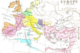
476: The 'end' of the Roman Empire. Image credit: website. ^
501 - 600 (The 6th Century):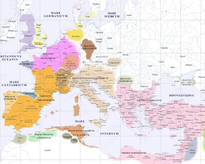
The 'Barbarian' overview. Image credit: website. ^
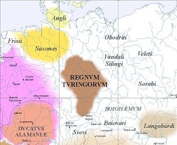
The Regnvm Tvringorvm [Thuringians] finally replaced the Hermondvri/Hermvndvringi in the Colditz area after about 450? years. Image credit: website. ^
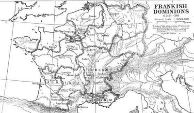
511 - 561: Frankish lands. Image credit: website. ^
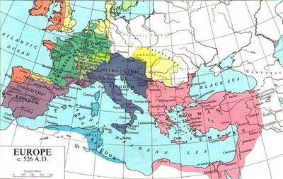 526: The Frankish Kingdom, with the Thuringians just beyond Frankish reach and control to the east. Image credit: website ^
601 - 700 (The 7th Century):
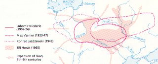
Slavic expansion moved across the Oder river to the west in the 7th and/or 8th century. Paul Robert Magocsi, Historical Atlas of East Central Europe, p. 6. ^
701 - 800 (The 8th century):
![]()